CONSTRUCTION SURVEYING AND INSPECTION
OUR DRONES QUICKLY SURVEY YOUR JOB SITE AND BUILD MAPS AND MODELS. INSTEAD OF USING HUMAN RESOURCES, HEAVY MACHINERY AND EXPENSIVE SURVEYING TOOL THAT PRODUCE COMPLEX DATA. WE CAN GET THE JOB DONE IN LESS TIME AND MONEY, LESS IMPACT TO OPERATIONS AND WITH CENTIMETER ACCURACY!
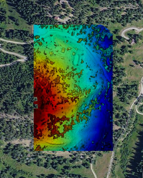
2D ORTHOMOSAIC MAPPING
Google Maps are great, but the images tend to be at least a couple of years old and lack the resolution for doing real work. Make your own maps and get a new perspective on things with accurate, high resolution imagery.


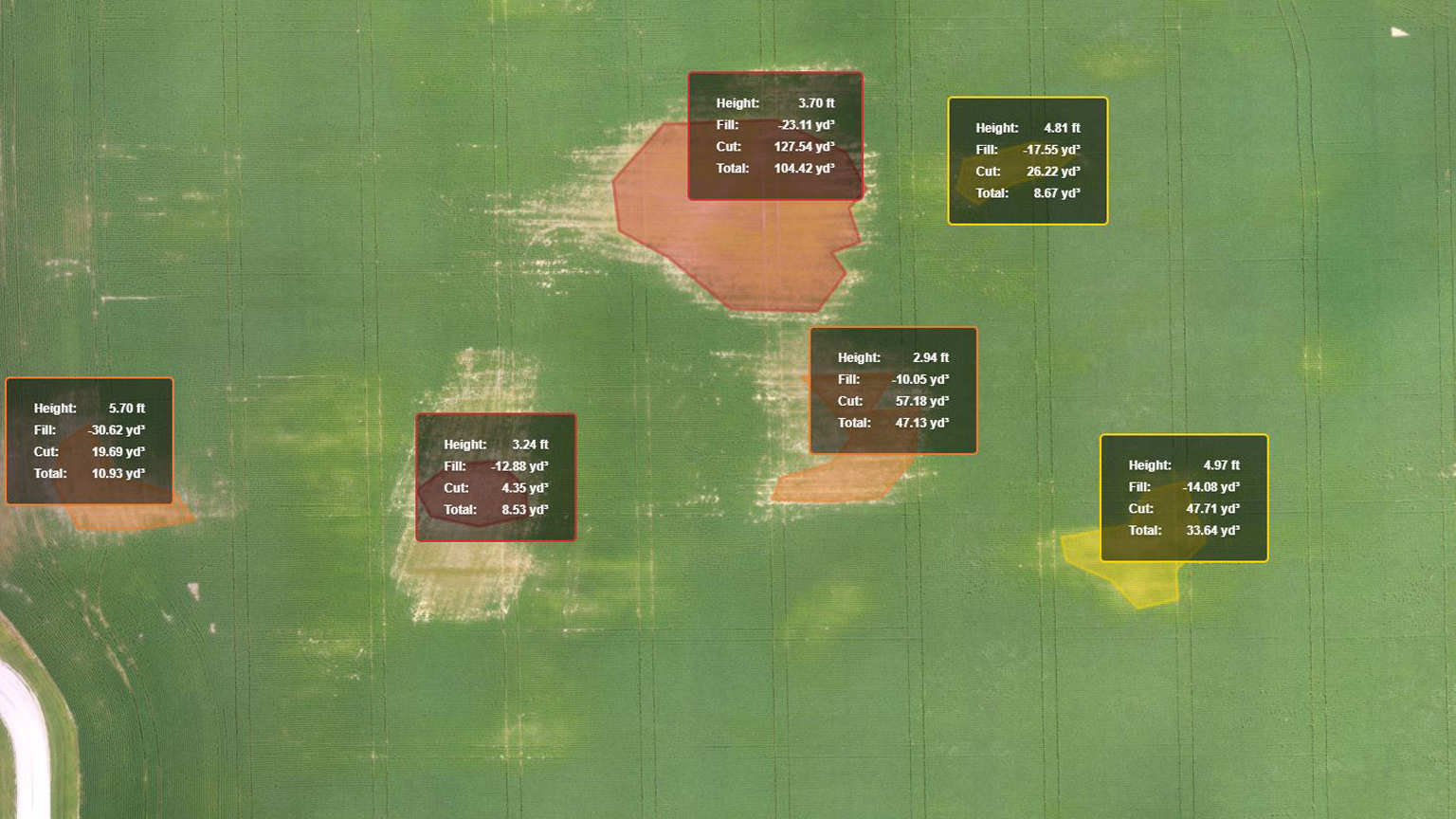
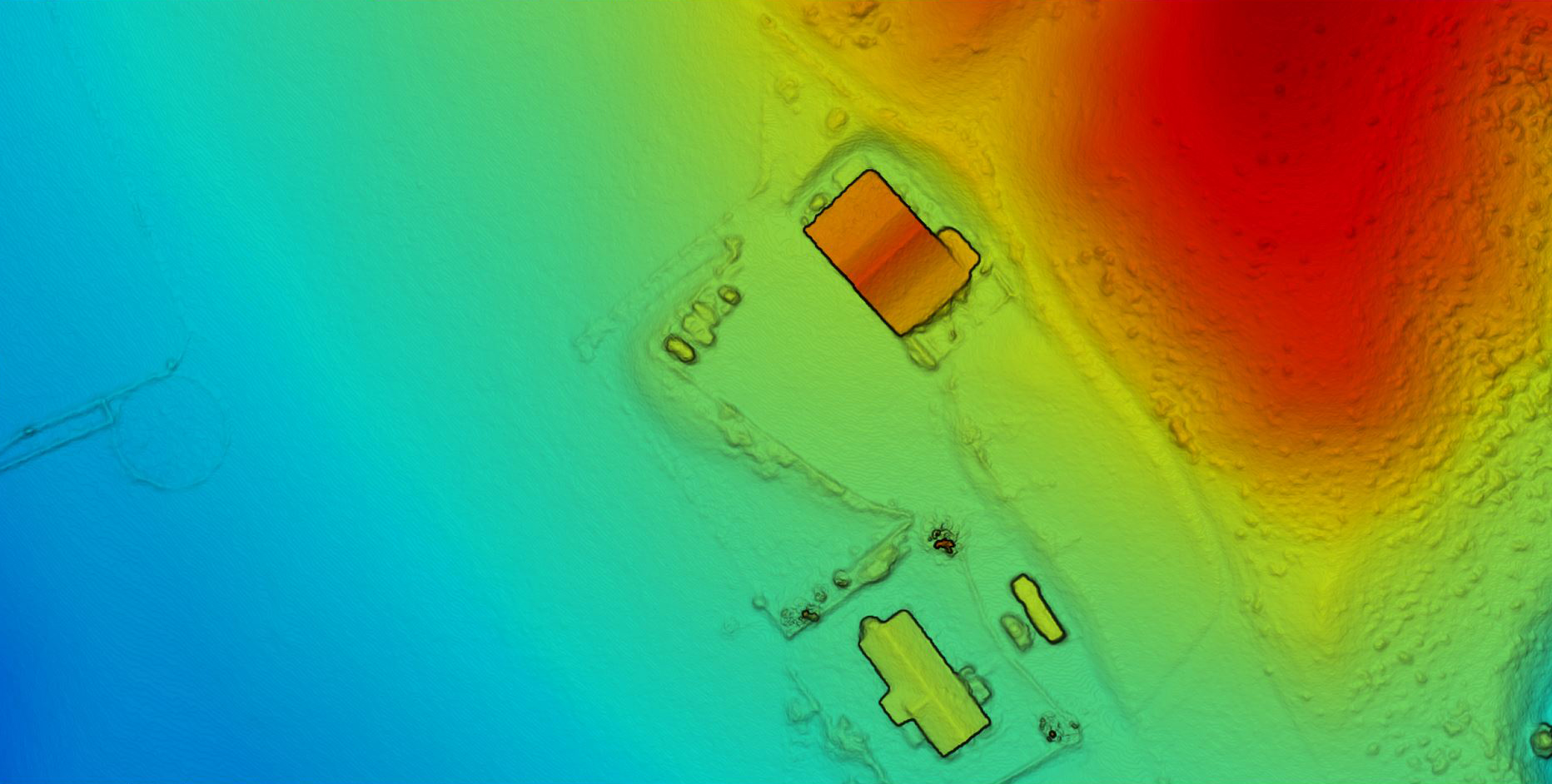
VOLUMETRICS
Our use of Aerial PHOTOGRAMMETRY WTIH GCP's has resulted in increased accuracy over traditional survey methods while creating detailed and accurate surface models incorporating areas that may have been missed by manual methods.

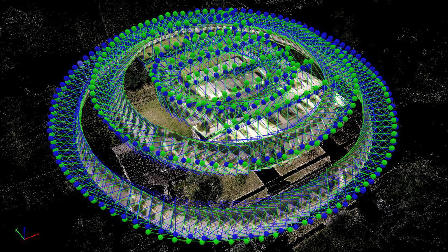
3D STITCH MODELING
3D mapping and surveying is a cost effective and timely solution with minimal disturbance of operations at the project site. Skyfire provides 3D volumetric mapping to our clients using PHOTOGRAMMETRY WITH 2CM ACCURACY. Our aerial platforms use the latest technology for a faster turnaround time, higher accuracy, and lower cost.